
Severe Weather Outlook Map
Outlook Area Description
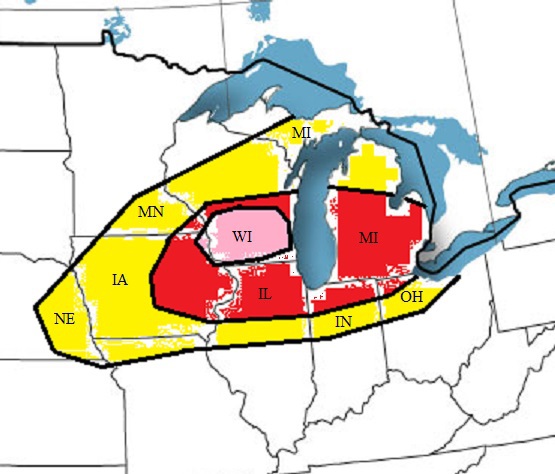
A possible derecho will race its way east across southern Wisconsin, Northern Illinios, and into Michigan through Monday morning. In its wake strong instability should occur, this should lead to a few supercell thunderstorms across lower Wisconsin late this afternoon. Yellow indicates where there is a risk of severe weather, red indicates the best chance for significant severe weather, and magenta indicates the best chance a tornado.
Five Day Outlook
Click on the day to see current Storm Prediction Center convective outlooks.
Severe Thunderstorms!
Severe storms across the south.
No severe storms.
No severe storms.
No severe storms.
Current Storm Prediction Center Details
{if:adminMode}
{end:if}
{trans:no-articles}
Current NWS Watches, Warnings, and Advisories
RSS feeds loading...
Welcome to the Weather Advisor
Our goal is to accurately predict the strongest storms.