
Archives
Previous Weather Predictions and event setups.
Event 4/8/2015
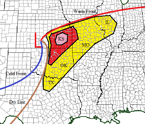
Severe thuderstorms will form Wednesday afternoon and evening, with large hail, damaging winds, and likely a few tornadoes. With temperatures in the 70's and 80's across the plains, and dew points in the low to mid 60's possibly reaching near 70, there should be plenty of instabillity for severe thunderstorms to form. The area with the best lift will probably be southeast Kansas as a cold front pushes into the area. As the cold front nears the dry line storms should explode across the red and magenta shaded areas. The area for the best chance to see a strong tornado tomorrow will be the magenta shaded area!